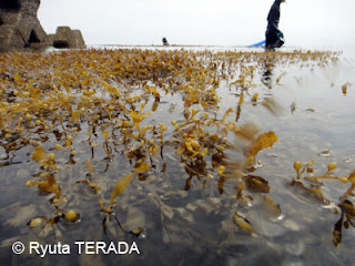
This year, as the conservation project of seaweed community that is supported by national and local governments, we will conduct the distributional survey of seaweed/seagrass community along the coast of Ohsumi Peninsula in the Kagoshima Bay. Distance of coastline is estimated more than 30km.
As the first day of our survey, we conducted it at the southern part of Tarumizu City.
初日は垂水市の南端から北に向けて調査をしました。柊原漁港の北側には,大きなアマモ場がありました。ここでライントランセクト調査をしました。
We confirmed a large seagrass bed at just northern part of Kunugi-Baru Fisherman's harbor.
垂水市南部の海岸は砂浜が多く,ガラモ場は沖合の離岸堤のまわりで見られました。
Coastal line was mainly consisted of sandy and muddy bottom. Then, Sargassum community was restricted only on the offshore rocks and artificial breakwaters.
2日目,今日は垂水港から北に調査をおこないました。ゴールは桜島との境(鹿児島市との境界)です。
Second day, we surveyed at northern part of the city. We collected the seaweeds/seagrass along the shoreline by SCUBA and snorkeling.
船で開始地点まで移動します。
垂水港から北は岩礁が見られるようになり,各地でガラモ場が見られました。
As the contrast, coastal line of northern part was mainly composed of rocks and boulders. There were quite a lots of Sargassum community.
 |
| マメタワラ Sargassum piluliferum |
桜島との境につきました。垂水市・・・海岸線が長かった・・・


